Views from McKnight Peak, the highest point in the Black Range.
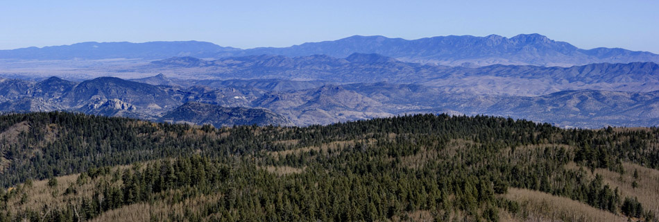
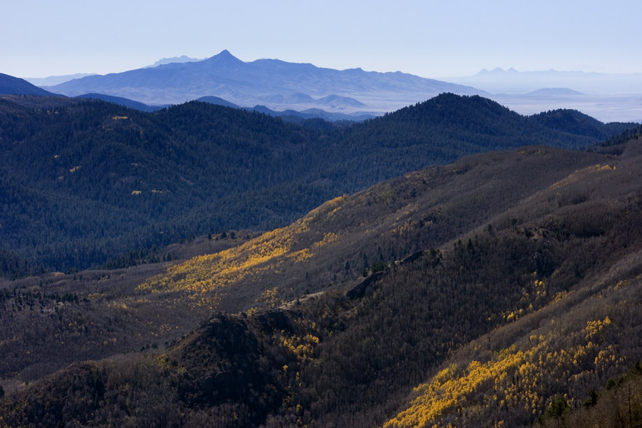
Looking west from McKnight Peak at the southeast end of the Mogollon Mountains on the right and the Pinos Altos Range on the left, 26 Oct 2008. The rightmost peak is Diablo Peak.
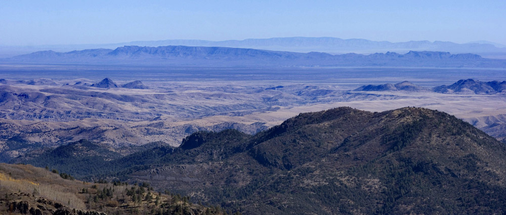
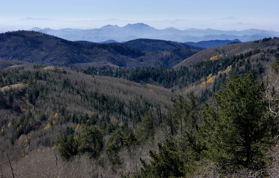
Looking east-northeast with the Fra Cristobal Range nearer and the Oscura Mountains distant, 26 Oct 2008. Very distant at far right is Carrizo Mountain.
Another view to the east-northeast, looking just south of the above photograph. The far north end of the Caballo Mountains is at right, with the northern San Andres in the nearer distance, Salinas Peak prominent at far left, and Sierra Blanca further out, just to the right of Salinas Peak. 26 Oct 2008.
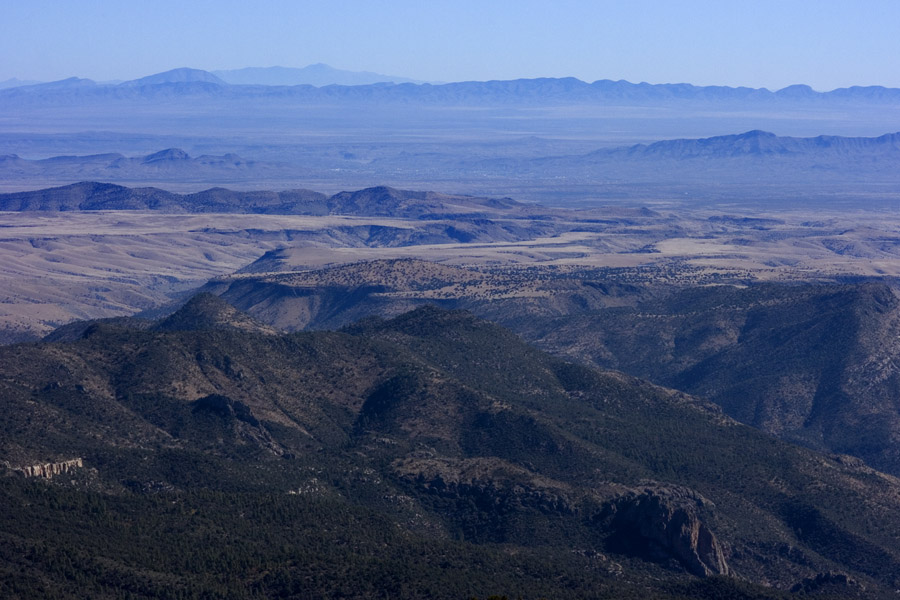
Looking east, with the Caballo Mountains nearer, the San Andres more distant (note Gardner Peak about 3/5 of the way from the left edge of the image), and the Sacramento Mountains forming the far distant ridge.
Looking southeast at the Organ Mountains, 26 Oct 2008. The Doña Ana Mountains are also visible, nearly lost in the haze.
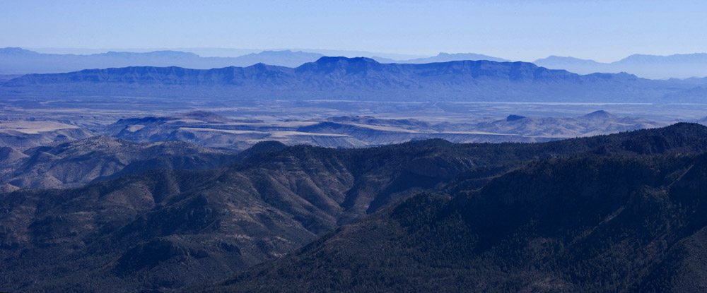
Looking south at Cookes Range, 26 Oct 2008. Peeking out on the left side of Cookes Range are the Florida Mountains, and distant at right are the three peaks of Tres Hermanas.
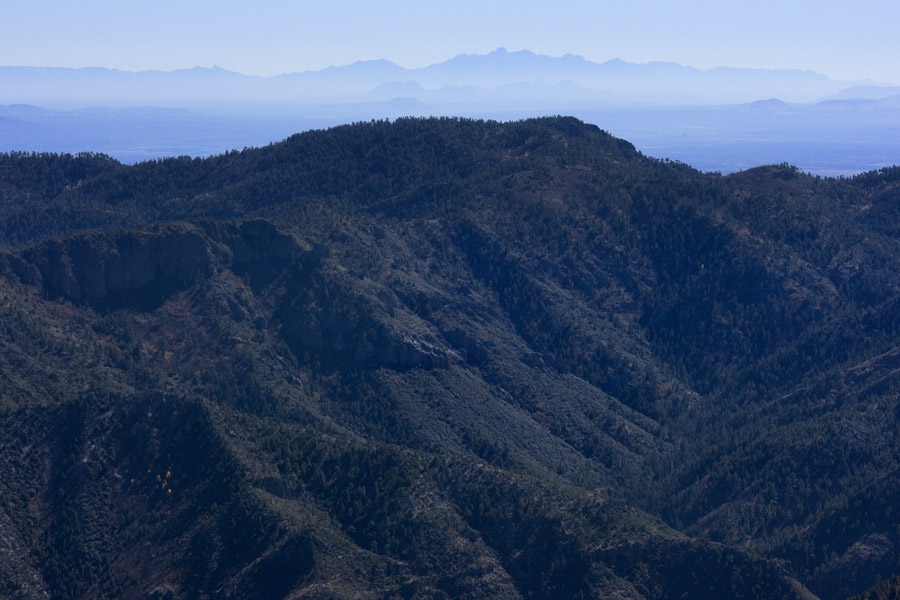
Looking south-southwest from McKnight Peak, 26 Oct 2008. Big Hatchet Peak is in the far distance at far right. Closer and slightly to the right of Big Hatchet Peak is Grandmother Mountain. The most distant peak at far left is, I believe, Cerro Grande in Mexico. The remaining small peaks between Big Hatchet Peak & Cerro Grande are mostly on the long, low ridge of the Cedar Mountains. The near peak slightly left of center is Mimbres Peak.
Go back to:
Grant County
The main NM map
The main index